How the AI reads aerial imagery →
Scope and source dates
Origins: 4,402 city-clipped 2020 Census blocks. Routes and environmental context extend 3 km beyond Plano. Trees: AI predictions from 2022 NAIP. Heat: summer 2025 Landsat surfaces. Population: 2020 Census. Housing/demographics: 2020–2024 ACS; disability at tract level.
Gray means unavailable or incomplete. Smooth colors do not create finer observations. Housing values describe areas, not individual homes.
Earlier nine-layer pilot map
Preserved for reference. It covers the original four ZIPs and is not the current municipal analysis.
Open original nine-layer map ↗
Equations & source maps · Relevant static maps
More maps Saved maps and charts
Walking time and walking effort
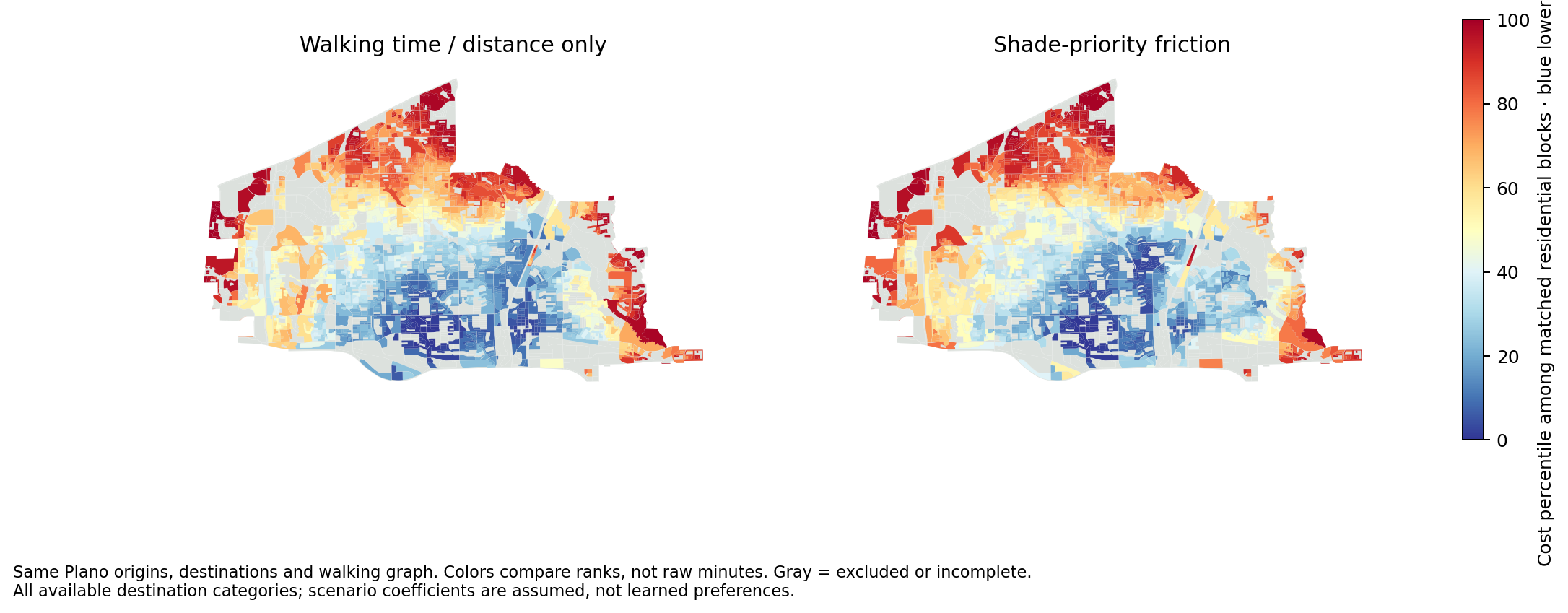 Same graph, destinations and origins. Matched cost-percentile scales.Download PNG
Where area rankings change
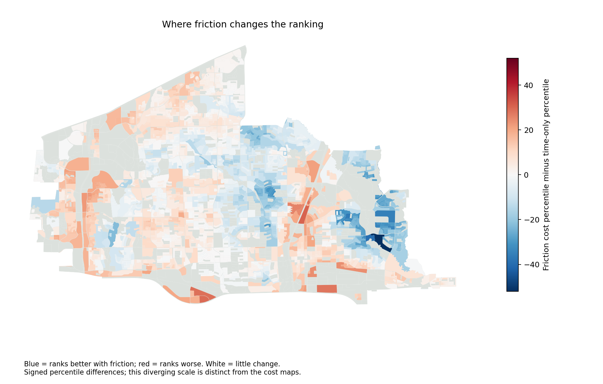 Friction cost percentile minus time-only percentile. Blue improves; red worsens.Download PNG
Do longer walks mean more effort?
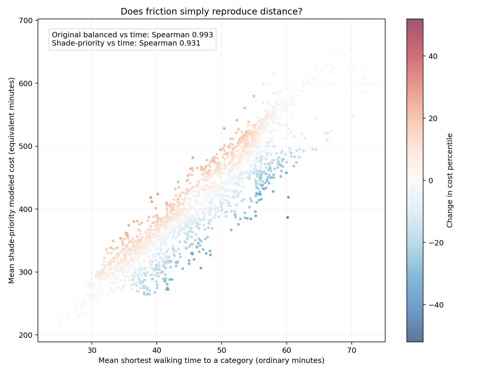 All-category comparison. Differences show model behavior, not validated human preferences.Download PNG
Walking effort across Plano
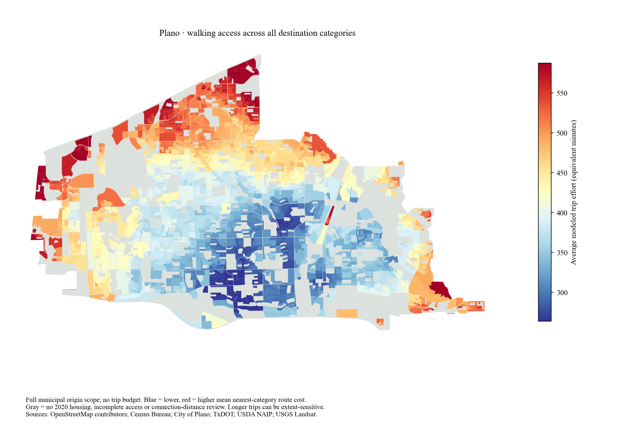 All available destination categories. Full municipal scope.Download PNG
Trees beside walking paths
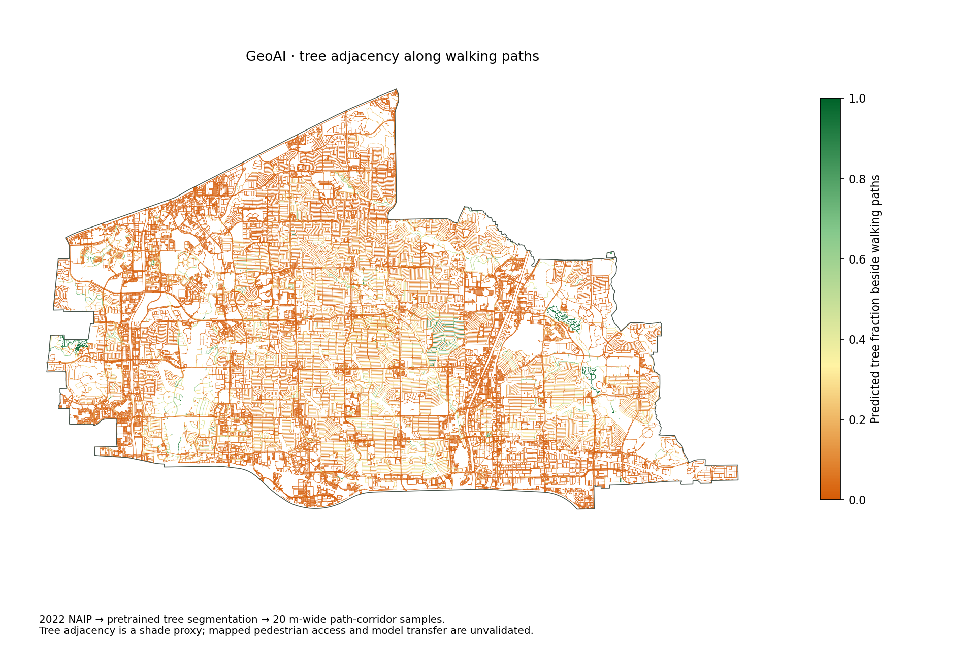 This path-level feature enters the routing cost.
Trees in each area
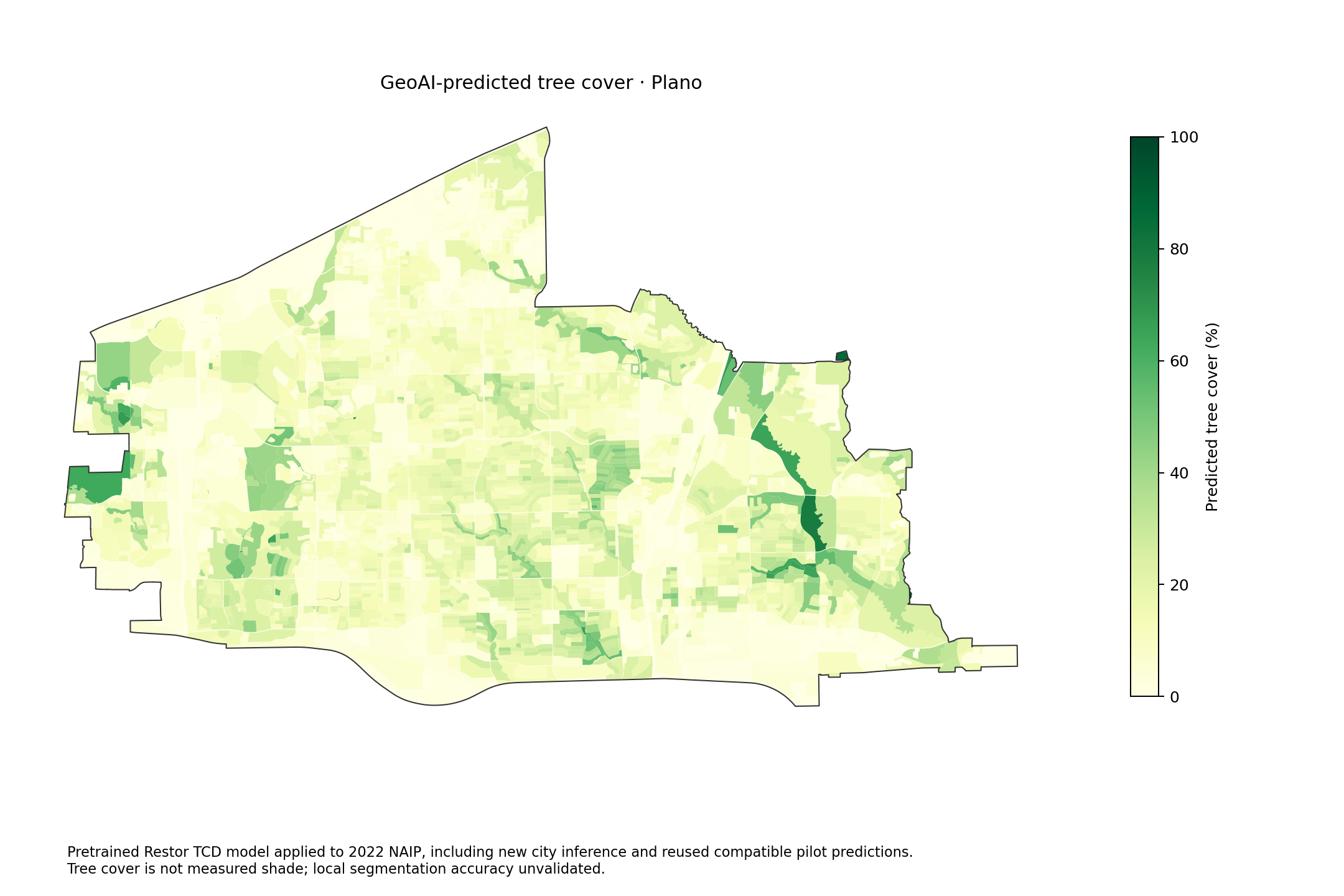 GeoAI predicts trees from 2022 aerial imagery. Nearby tree cover informs each walking-edge cost; it is a shade proxy, not measured shade.Download PNG
Summer surface temperature
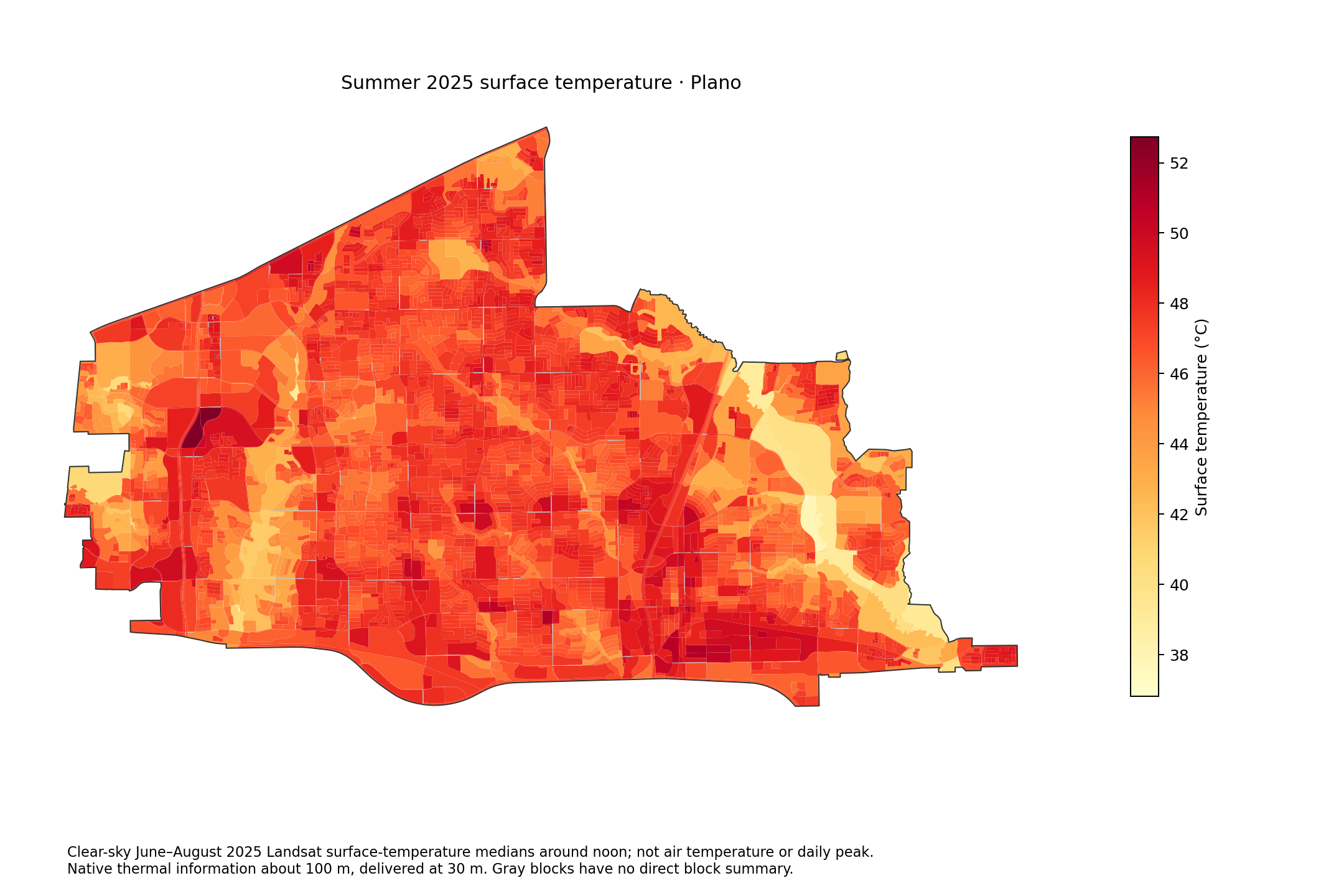 Clear-sky summer 2025 Landsat composite. Surface temperature, not air temperature.Download PNG
Traffic volume
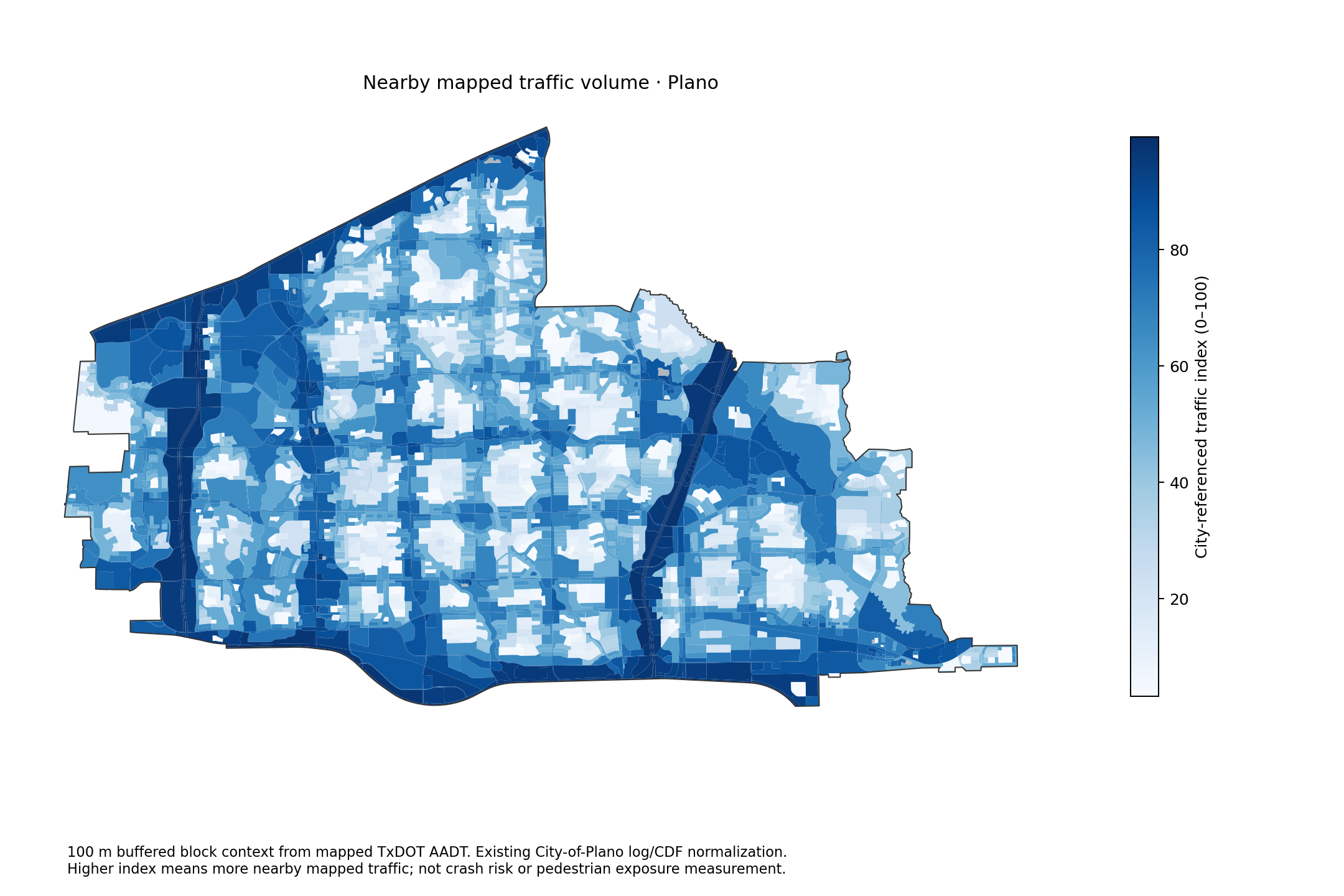 Nearby mapped TxDOT AADT, normalized against Plano. Not a crash-risk measure.Download PNG
Population density
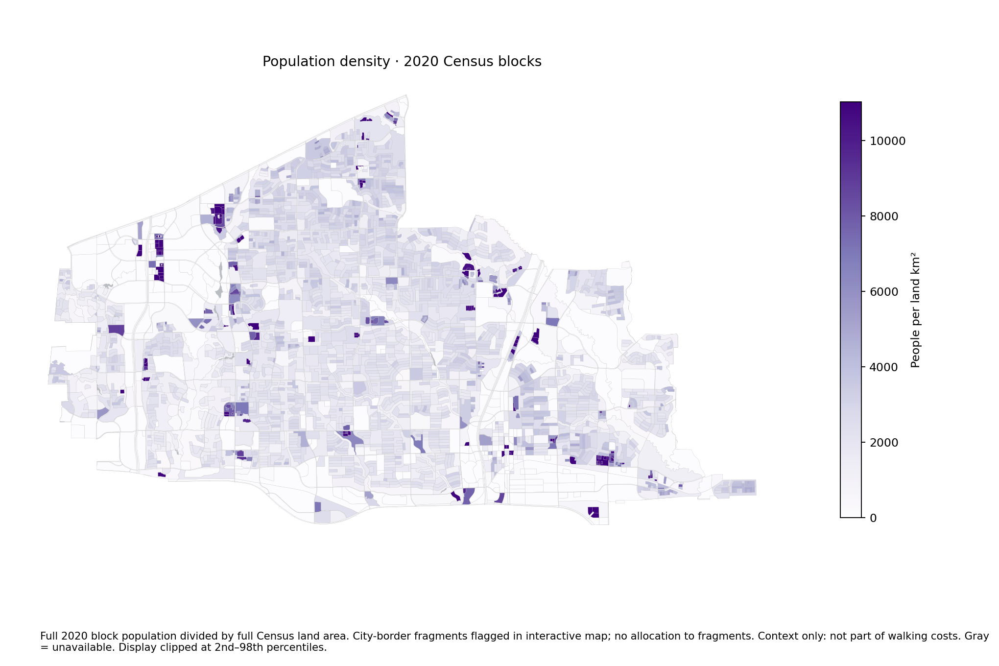 2020 Census residents per land km². Full-block values; city-border fragments flagged in the master map.Download PNG
Area median rent
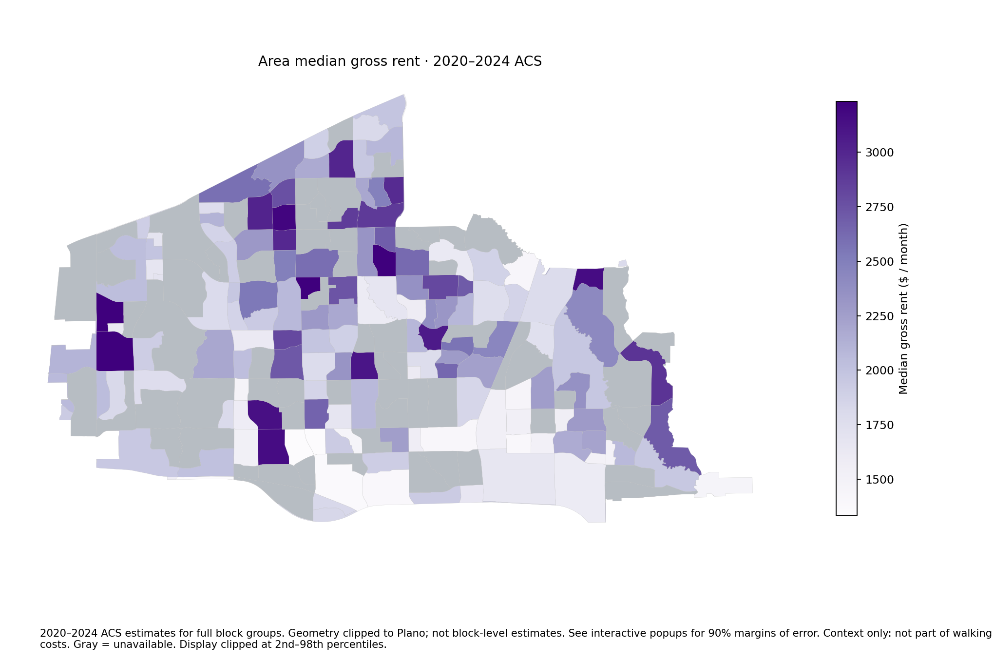 2020–2024 ACS block-group estimates. Not current listings.Download PNG
Area median home value
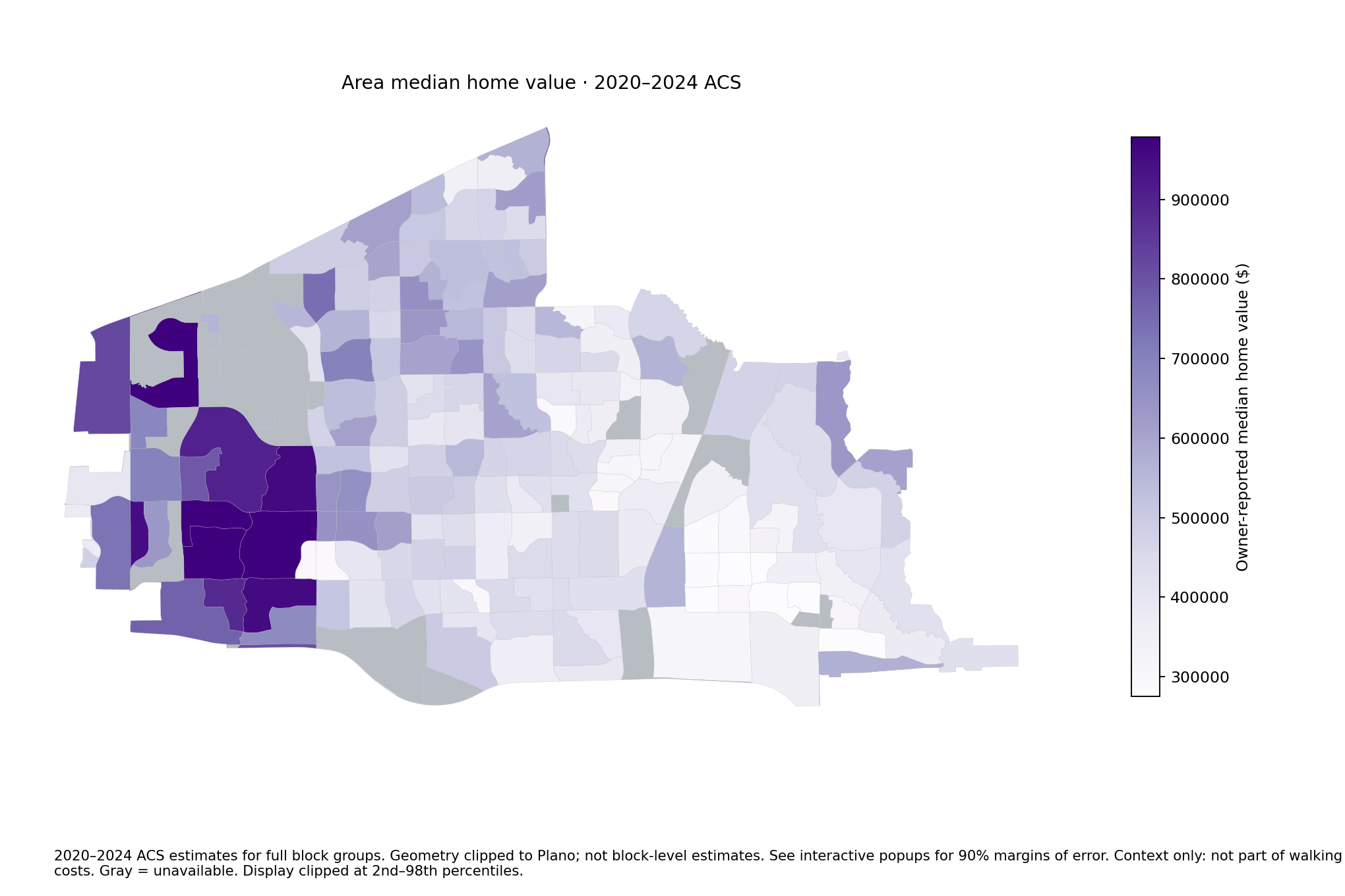 2020–2024 ACS owner-reported values. Not individual appraisals.Download PNG
Mapped walking paths
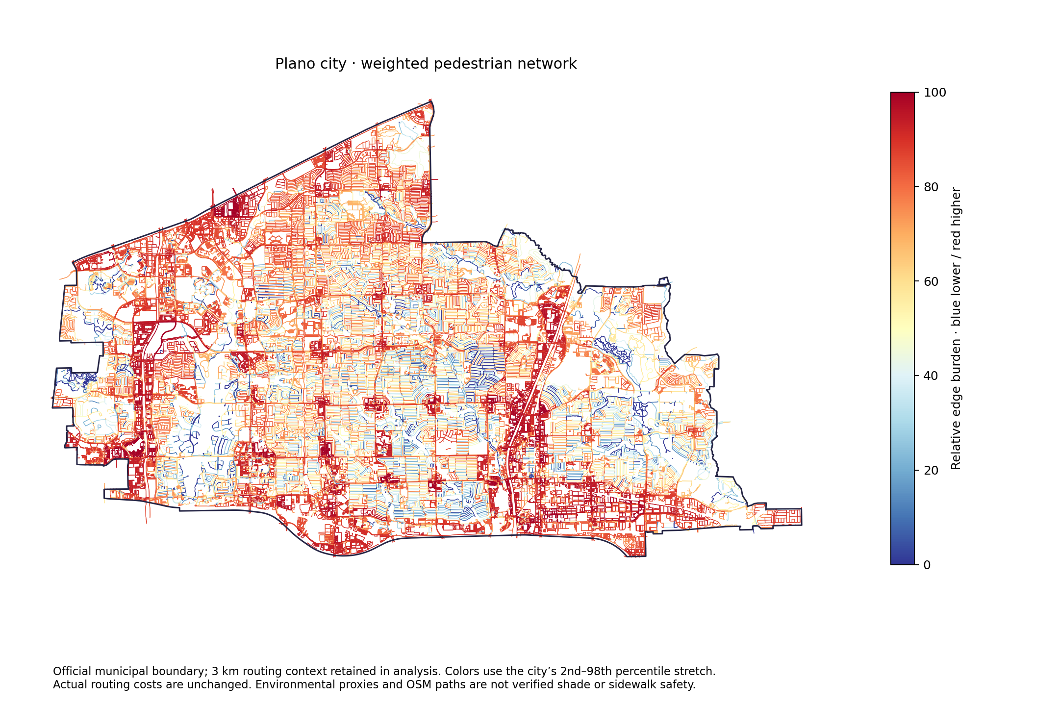 Actual mapped edges, with environmental context. Routes extend 3 km beyond Plano.Download PNG
Earlier experiments and four-ZIP maps